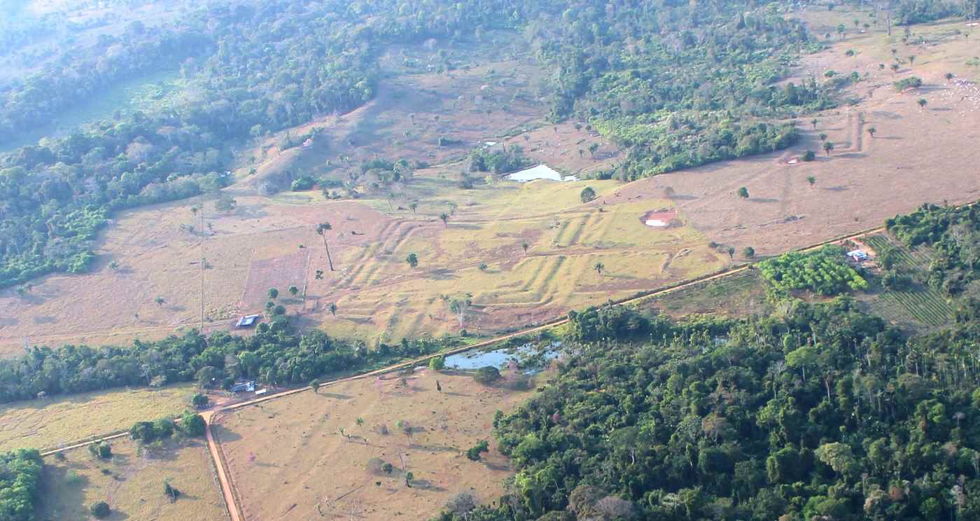
A study published in Nature reports that airborne LiDAR surveys over 4,497 square kilometers of the southwestern Amazon have identified 432 geometric earthworks, 396 of which were previously undocumented. The survey area surrounds the modern cities of Rio Branco, Lábrea, Boca do Acre, and Carauari in Brazil.
Researchers led by Martti Pärssinen of the Ibero-American Institute of Finland used Light Detection and Ranging technology, which penetrates forest canopy to map ground-level features in fine detail. The earthworks, known as Amazonian geoglyphs, consist of ditches and embankments forming geometric enclosures ranging from 0.35 to 14 hectares, with the largest covering nearly 123 acres.
Construction of these geoglyphs began around 2,500 years ago and continued, with stylistic changes, until as late as the 13th century. The civilization, referred to as the Aquiry, is believed to have reached its peak scale and wealth between the 1st and 4th centuries CE.
By extrapolating the LiDAR findings and combining them with existing satellite data, the authors estimate the region may contain between 24,000 and 30,000 earthworks in total. This would place the concentration of structures in just 3% of the Amazon basin above that of the remaining 97%.
Previous population estimates based on roughly 200 known earthworks suggested around 60,000 people. The new data leads the authors to propose a population of 1.25 to 3 million for the period 100–300 CE, comparable to Late Preclassical Maya societies.
The estimated extent of the Aquiry civilization has tripled from an earlier 60,000 square kilometers to approximately 183,000 square kilometers. The authors note that this cultural area alone now contains as many earthworks as were previously estimated for the entire Amazon basin.
The geoglyphs are assumed to have functioned as ceremonial, political, and public gathering centers. The Aquiry civilization is known almost exclusively through these structures, and the study represents a major advance in understanding a society about which little information has been available.
LiDAR has driven a series of significant archaeological discoveries in the Amazon over the past two decades, repeatedly revealing large-scale precolonial landscape modifications hidden beneath dense forest cover.
Archaeologists Triple the Scale of an Ancient Amazonian Civilization We Know Almost Nothing About
This is an independent summary. The complete reporting, supporting context and any primary documents remain with Good News Network.